News from Sierra Nevada Guides

Latest news from the Sierra Nevada Mountains of Southern Spain
Showing posts with label Walking in the Sierra Nevada. Show all posts

Wednesday, 16 November 2016

The Tour of Mulhacen

“The best and most varied multi day trek in Spain’s Sierra Nevada”

Mulhacen is 3482m high and is the highest mountain in mainland Spain and indeed the Iberian Peninsular.  It is situated in The Sierra Nevada National Park near the city of Granada around two hours drive from Malaga.

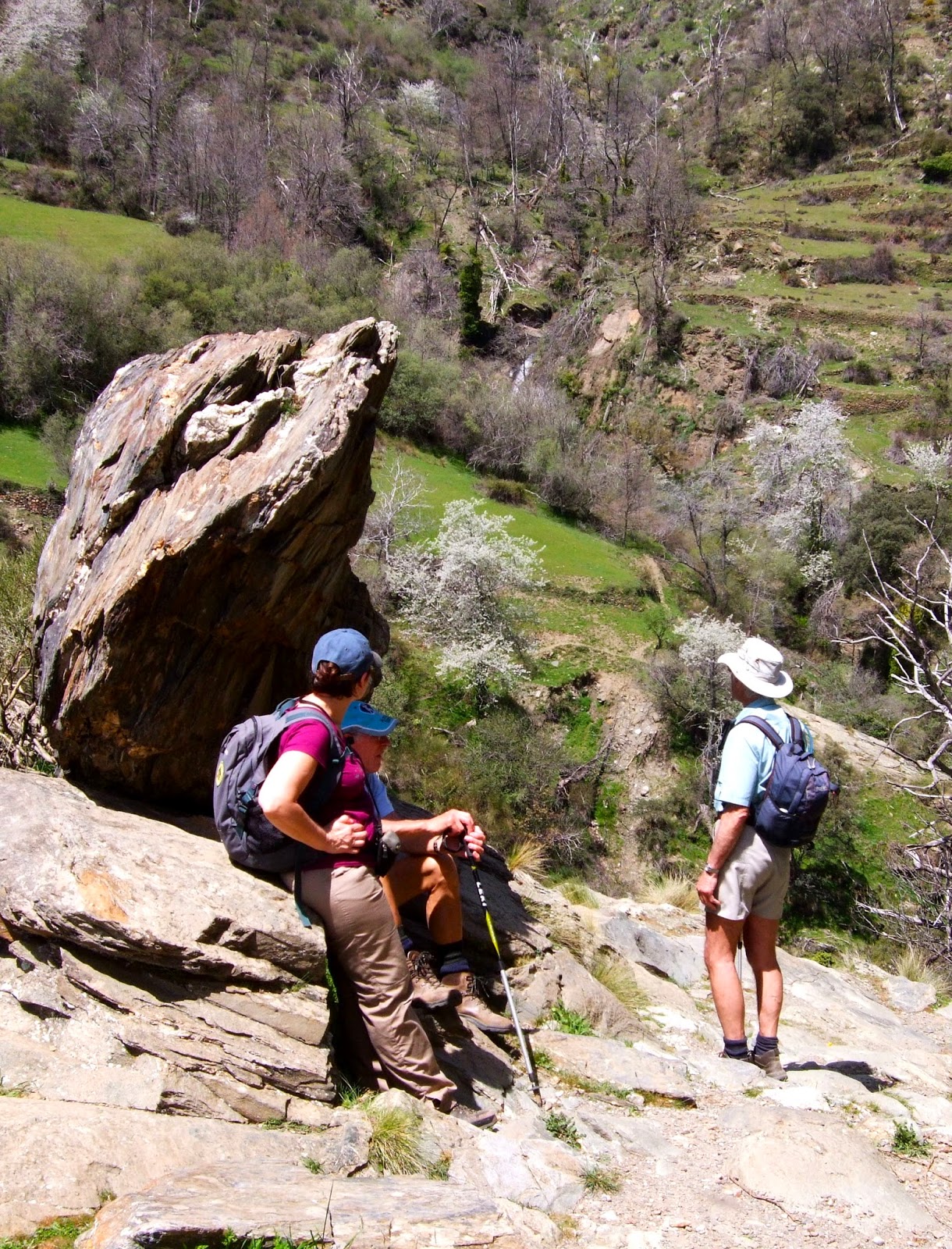
Early season, the route from Mulhacen's South Ridge to the Refugio Poqueira.


There are several long distance trails passing through or around the Sierra Nevada but none that combine the villages, the highest peaks and pass through the different and varied climatic / wildlife zones in a way that can be enjoyed without camping or bivouacking.

Mulhacen from The Caldera
Our aim with The Tour of Mulhacen is to combine all of the best aspects that make the Sierra Nevada National and Natural Parks a special pace to enjoy into a week long holiday. This includes ascents of the two highest mountains in the Sierra Nevada: Veleta 3396m and Mulhacen 3482m.

The Sierra Nevada is Spain’s largest National Park. It’s uniqueness stems from the large number of endemic species (over 100 with 63 species of endemic plants). During the Tour of Mulhacen we hope you will be able to spend time appreciating the unique and special landscapes that you are passing through.

The Sierra Nevada with its proximity to Granada was part of the old Arab Kingdom of Al Andalus. In fact the name Mulhacén is derived from Muley Hasan, the penultimate Arab king, who legend states is buried on the mountain. The southern slopes of the Sierra Nevada are known as the Alpujarra and are characterised by pretty white villages in the Moorish style. Capileira, where this walk starts and finishes is perhaps the prettiest.

The route is a journey through some high and remote places. In summer the weather is generally good with little rain in June and usually none at all in July and August. September is mainly fine but there are usually a couple of stormy days which can result in snow high up. In any month there can be high winds making the higher parts of the route difficult, also it can be misty with low cloud.

Apart from the (2 days) sections walking along the GR240, there is no signposting to be relied on. Good map reading skills, a compass and knowing how to use them is essential.

The Tour of Mulhacen, near Trevelez.


Day 1           
Capileira to Trevelez.
A route following the GR240 between the two highest villages in mainland Spain.
6 to 7 hours walking with about 800m of ascent.

The endemic, "Star of the Snows"
Capileira 1436m is a very pretty mountain village with lots of bars and hotels. The information centre is situated beside the bus stop almost opposite the Bar Moirama. Here it is possible to buy maps.

The Spanish are not known for their early starts, however for the first two days, starting from a lowly height of around 1400m to 1500m it is advisable to make an early (ish) start to avoid the heat of summer.


Today’s walk follows the GR240 to Trevelez, The first two hours being uphill to Hoya del Portillo 2100m. Fortunately a lot of this climb is in forest that provides shade. Once above Hoya del Portillo the mountainside opens out and we leave the forest. This is a fairly arid hillside but where there is water look out for some spectacular plants. Crossing this hillside in the afternoon regularly give sights of both eagles and vultures circling above.

Trevelez 1476m is the highest village in mainland Spain. As such it is famous and it is also a centre for curing hams in the dry mountain air. Perhaps not so pretty as Capileira but still a very nice picturesque village.


Day 2           
Trevelez to The Postero Alto Refuge.
Ascending the Rio Trevelez to Puerto Trevelez before descending to the Postero Alto Refuge. About 8 hours walking with 1500m of ascent.

Refugio Postero Alto
Today’s walk is probably the hardest day of the Tour of Mulhacen. This is due to reaching the steep slopes of El Horcaio in the heat of the day. However it is a great and varied days walking.

We head out of the village to the north following joining and following the Rio Trevelez. This is a verdant valley, very green, even in the height of summer. As we climb we pass through summer farms where the farmers still use horse to access their high farms.

Once we have scaled the slopes of El Horcaio, the mountain path is more gentle beside a nice mountain stream that we follow to today’s high point of Puerto Trevelez 2800m where we cross the main east / west ridge of the Sierra Nevada and descend down to the Refugio Postero Alto 1880m.

The Refugio PosteroAlto is a unique building sometimes described as “The Hobbit House” with its many adjoining extensions.


Day 3            Postero Alto Refuge to The Pena Partida Refugio (shelter).
An easier day with a chance to pass the spectacular waterfalls of Los Lavaderos de la Reina. About 6 hours walking with about 650m of ascent.

Iberian Ibex, a common sight
Today we will follow the GR240 path past the Lavaderos de la Reina, spectacular waterfalls in the early summer due to the vast amount of  melting snow on the high peaks. A chance to follow some spectacular “acequia’s” which are old water channels originally constructed by the Arabs to share the water around the mountain sides brining more farmland into use.

The Pena PartidaRefuge 2451m is just a stone shelter with a wooden sleeping platform. For this night you will need to carry a sleeping mat, sleeping bag and any spare clothes you need. This is the only night on The Tour without a manned refuge or hotel. If undertaking this trip with Mountain Walking Holidays, there is a certain amount of support available so a meal will be prepared for you!


Day 4           
Pena Partida to The University Albergue at Hoya de la Mora
16.5Km with 1400m of ascent. About 8 hours walking.

The Virgin of the Snows,
Hoya de la Mora
We continue along the GR240 descending to cross the Rio Genil and to a path know as the “Vereda de la Estrella” or “Path of the Stars.”  From here we start our ascent on little used paths to the Valley of San Juan which we cross to the old observatory and to The University Albergue atHoya de La Mora 2500m where we will spend the night in relative comfort.


Day 5           
Hoya de la Mora to the Refugio Poqueira via the high peaks 
of Veleta (3394m) and Mulhacen (3482m).
Not as hard as you might think!  We take the National Park bus 
from the Albergue to 3000m before the ascent of Veleta. 
Between Veleta and Mulhacen it is mainly easy walking apart 
from the final 400m climb. Our descent off Mulhacen is down 
the gentle South Ridge to the Refugio Poqueira. We end the
day with a celebration in the Refugio Poqueira 2500m
16.8Km with around 950m of ascent.


Refugio Poqueira with Veleta 3396m in the background


Day 6            Refugio Poqueira to Capileira
A descent of the delightful Rio Poqueira back to Capileira. 4 to 5 hours.


When to do this route
Enjoying the Summit of Mulhacen 3482m.
This route really needs to be done after the snow has melted making it a safer undertaking. Most years The Tour will be in condition from mid June through until mid October. The Alpine flowers are especially good at the beginning of July.  That said there are some areas of concern:

i.          The Refugio Postero Alto is only open throughout the week in July, August and September. Other months it is only open at weekends.

ii.         Snow often lies across the route near the Carrihuela Refuge (Day 5) until mid July. This re-freezes overnight and can be difficult to cross especially early in the day without crampons.


Accommodation and Campsites
There is plenty of hotel accommodation in both Capileira and Trevelez. In Capileira we have used several Hotels but the cheapest is the Hostal Moirma which we found perfectly adequate. If you need an early breakfast, best buy provisions in and have it in your room as you are unlikely to get anything before 8am. The Bar Meson Poqueira does a good tostada from 7.30am.

In Trevelez The Refugio Alpujarra Alta is good basic accommodation, though there are plenty of hotels.  Both Capileira and Trevelez have mini supermarkets.

A beer at the Refugio Poqueira.
The Refugio Postero Alto and  Refugio Poqueira need to be booked in advance. They provide good wholesome meals, have a bar and limited shop where you can buy basic items such as chocolate and biscuit bars.  The Refugio Poqueira has hot showers available and you can rent a towel.  For both refugio’s you will need a sheet sleeping bag.

The refugio Pena Partida is a basic bothy with table and chairs and a sleeping platform.


The University Albergue at Hoya de la Mora is a very basic hotel. They serve reasonable meals and will make you a packed lunch. If you are intending to use the National Park bus to gain height from here, this can be booked when you make the Alberge booking.

There are Official Campsites at Trevelez and Pitres (20 minutes drive from Capileira).

It is possible to wild camp in the National Park though there are some rules to follow (available either direct from the National Park or in leaflet form in English from the Information Centres). However this route as described does not require “wild camping” in the traditional sense and would be difficult within the rules dictated by the National Park.


Maps and Guidebooks
The Editorial Penibetica 1:40k Map, “Parque Nacional de Sierra Nevada, La Alpujarra, Marquesada del Zenete” is perfectly adequate for the route and comes with a guidebook (in English) to the Area. It is available from Stanfords and we recommend that you get it laminated prior to your trip as it is very flimsy.

It is also available from the Information Centre in Capileira and some shops and bars.


Other multi day treks in the Sierra Nevada
There are several other long distance routes that pass by or through the Sierra Nevada and Alpujarra. 

The GR240 is Spain’s longest circular long distance footpath that circumnavigates The Sierra Nevada in 19 stages. The only villages it passes through are Capileira and Trevelez so stocking up with provisions is difficult if doing it in one complete outing.


The GR7 crosses the western edge of the Sierra Nevada near Lanjaron and continues through the Alpujarra.


The “Integral” is a traverse of all the 3000m peaks of the Sierra Nevada, usually from east to west.  There are some variations on the route and most people spend 3 or 4 nights wild camping along the route.


The Tour of Mulhacen as a Supported Trek:

Our sister company, MountainWalking Holidays offer this itinerary as a supported trek.

The route to Mulhacen as seen from the Carrihuela Refuge near Veleta.

Sierra Nevada Guides are the only Qualified British Guides living and working in Spain's Sierra Nevada.


Friday, 5 February 2016

Undiscovered Routes

One of the great things about walking in this area is that not many other people do it. Routes are not massive erosion scars as in the popular areas of the UK and you can walk without crowds of people. It also means that routes are still out there to be found and whilst it might not be the first time they are walked often it is clear that they are little used. This happened to me recently when I ‘’discovered ‘’ a new route following the line of an acequia in the Rio Trevelez valley. I first spotted the line of what I though at the time might make a great walk during last summer. I was a passenger in a coach full of clients returning from a days walking near Trevelez. Returning back down the valley I saw a clear straight line running across the cliff face on the mountain side which creates the south side of this rugged valley. Later in the year when I was this time driving down the road I managed to stop and inspect the line using a pair of binoculars , even from a distance it looked like a dramatic line but it was still not clear that is would ‘’go’’ . I finally got around to going out to actually having a look last week and finally discovered that the line I had seen threading its way through steep cliffs and scrub was in fact an acequia and that it could indeed be walked. I set off along what was at first a fairly wide concrete channel crossing open hillside. On turning the first corner it became clear that the line was going to be more than a normal acequias walk. The channel has been cut through steep cliffs, passes below overhangs, is in places pinned to vertical rock sections and includes a couple of natural rock archways. The second of these is so tight that it required removing my rucksack and a squirming along the bottom of the acequias in order to continue the route. For some , my wife included it sounds like the worst possible sort of walk but if you have a head for heights the km or so of channel makes a wonderful walk. The dramatic section of what turns out to be the Acequia Almegijar comes to an end on a waymarked path running through the area called the ‘’Ruta Medieval’’. This trail links the white villages through the Taha area of the Alpujarra valley and is worth seeking out in its own right.

Monday, 5 January 2015

Cabra de Montana

In a recent article in Granadas Ideal newspaper I read of a project based in the Rio Dilar area of the Sierra that was investigating the life cycle of Cabra de Montana, the wild mountain goats often seen across the whole region. Many of you who walk regularly in the area will have seen these ‘’mountain goats’’, normally running away into the distance. For those who haven’t these truly wild animals are about the size of a fallow deer, they are a tan colour with darker shoulders and haunches with the larger older animals having a pair large sweeping horns. Well suited to the mountain terrain where they are generally found they have short muscular legs and large soft hooves which are perfect for gripping steep rock faces. Generally browsers they live in areas of mixed scrub and broken ground in the lower mountains but I have seen them at 3,000m near the Caldera refuge on Mulhacen, on the edge of Lanjaron and also on the coast near Cerro Gordo. Often the only sign you have that they are in the area are large amounts of droppings on summits though you will often hear a sharp high pitched call as outlying individuals warn a larger group that you are approaching. The groups you see will either be made up of females with their young or males. The two groups do not generally mix apart from the breeding season in autumn. This is also the time when males fight for dominance of a herd with head butting contests. My first sighting of ‘’cabra’’ was about 10 years ago whilst descending the south ridge of Mulhacen. Needless to say seeing one of these animals for the first time was quite a shock particularly as it was quite a large male with a fantastic pair of horns. I have become accustomed to looking out for them but even so it’s often not until they move that I spot them as they are well camouflaged and blend into the backgrounds remarkably well. Whilst often called mountain goats these animals are actually a type of Ibex, Capra pyrenacia . At one time there were a total of four subspecies. One, a Portugese subspecies, died out in 1892. Shockingly the other, Capra pyrenaica pyrenaica, became extinct on the 6th January 2000. A remarkably specific date. However this was when the last known specimen of a subspecies peculiar to the Pyrenees died. A frightening example of how easily we can loose unique animals. The two remaining subspecies however seem to be doing well and at the moment at least appear to be growing in numbers with an estimated population across the Iberian Peninsula of about 50,000.

Wednesday, 20 August 2014

Autumn Walking in the Alpujarra and Sierra Nevada


Autumn Walking in the Alpujarra and Sierra Nevada

We have spent the summer months leading walks in the high mountains where the air is cooler. With the end of August looming the temperatures in Southern Spain start to fall and walking in the Alpujarra will become a comfortable experience again.  We are looking forward to getting re-acquainted with some “old favourites” classic walks in the Alpujarra, walks we have done many times before so good that you never tire of them!

Dramatic gorge in The TaHa
One such route is a circuit in The TaHa de Pitres following medieval packhorse trails and improbable looking paths through cliffs and rocky buttresses, crossing a Roman bridge and passing through impressive scenery more reminiscent of The Inca Trail than Southern Spain.

Walking in the high mountains is still possible too. Although any rain may fall as snow it usually does not lie for long until November when it starts to build up. (the ski resort usually opens the last weekend of November). Last year, the National Park bus from Capileira up to 2700m for an ascent of Mulhacen continued until the end of October. However caution 
Walking The TaHa in Autumn
should be exercised on the high routes and always check the weather forecast and go equipped with the right clothing.

Another Old favourite, the mountain Trevenque 2080m which is too low and therefore hot becomes an option again in the autumn. Trevenque is a shapely mountain, sometimes described as the Matterhorn of the Sierra Nevada and has a short scramble to reach the summit. Well worth the effort, especially if you make a circuit.


There are too many good walks to list in a blog but there are detais of 10 walks that can be downloaded from the Sierra Nevada Guides website.

Trevenque


At Sierra Nevada Guides we are keen to ensure that your visit to the area is as safe and enjoyable as possible.  We are happy to answer your questions whether you hire a guide from us or not!

Mike, Jane and Martin from Sierra Nevada Guides are all qualified International Mountain Leaders. Detais about us and of our qualifications are listed on the Sierra Nevada Guides website.


Thursday, 20 March 2014

Guided Walks in the Alpujarra and Sierra Nevada

Sierra Nevada Guides are pleased to announce their programmes of guided walks for the coming spring and summer seasons. Details are on the Sierra Nevada Guides website.

Walking in The Taha Gorge


The Spring programme of walks in the Alpujarra also includes an ascent of Trevenque 2079m which though not being in the Alpujarra is a fine "low altitude" peak sometimes described as the "Matterhorn" of the Sierra Nevada. The walk through the Taha being one of the best hill walking days you'll find anywhere...........

Walkers in the Alpujarra
Mondays - Hills and Terraces and Acequia's above Lanjaron, walking with a local landowner / guide who will explain the local landscape, farming and wildlife. 5 to 6 hours, a little strenuous.

Tuesdays - A circuit in the Taha walking a medieval path through old "arab" villages through terraces and a spectacular gorge crossing a Roman bridge. Not to mention the water fountain with naturally carbonated water! 5 to 6 hours walking, strenuous.

Wednesdays - An ascent of Trevenque 2079m, the Matterhorn of the Sierra Nevada. 5 hours walking, with one steep strenuous ascent / descent.

Thursdays - A circuit in the Rio Poqueira and the pretty white villages of Capileira, Pampaneira and Bubion.
5 to 6 hours of walking a little strenuous.


Fridays - Glimpses of Mulhacen!
A walk in the forrests above Capileira to Hoya del Portillo and Puerto Molina 2380m. 5 to 6 hours walking a little strenuous.

All of the guided walks are priced at 40 Euro's per person and are led by qualified British, International Mountain Leaders.


The Summer programme - of walks in the Sierra Nevada is aimed at tackling the higher peaks which will be a cool relief to the heat of summer.  These include ascents of Mulhacen 3482m the highest mountain in mainland Spain, Veleta 3396m,  Alcazaba 3364m and Caballo 3011, Europes most westerly 3000m peak.


Walkers at The Caldera Refuge, Sierra Nevada

The upper Rio Lanjaron near Caballo
Mondays - Mulhacen 3482m, the highest mountain in mainland Spain. Starting in Capileira and catching the National Park bus to 2700m, we ascend Mulhacen's south ridge to the summit. Our descent is down the west flank with glimpses of the impressive north faces of both Mulhacen and Alcazaba before reaching the Caldera Refuge, Rio Mulhacen and Poqueira Refuge. 8 hours of walking, 1100m of ascent, fairly strenuous.

Tuesdays - Veleta 3396m, the 2nd highest mountain in the Sierra Nevada. Starting from Hoya de la Mora at 2500m.  After the summit we visit the Carihuela Refuge and the Lagunas de la Virgin. 7 hours. A day mainly on good paths that is not too strenuous.

Wednesday - Alcazaba 3364m, the 3rd highest mountain in the Sierra Nevada and most remote of the big three. Starting in Capileira and catching the National Park bus to 2700m, we ascend Mulhacen's south ridge before traversing around to Siete Lagunas. We then make a circuit on Alcazaba descending through Siete Lagunas with its wonderful flowers before traversing back around Mulhacen to the start.  7 to 8 hours of walking with 900m of ascent, some steep and off path.  This is a strenuous day.

Thursdays - Caballo 3011m, Europe's most westerly 3000m peak. Not to be missed or underestimated. A route taking in not only the summit of this fine peak but our descent takes us to the Caballo Refuge and into the upper Rio Lanjaron. 8 hours of walking, 1100m of ascent, a strenuous day out.

Fridays - Mulhacen 3482m, a repeat on Monday's itinerary.

Like the Spring itinerary, all of the guided walks are priced at 40 Euro's per person and are led by qualified British, International Mountain Leaders.

Further details and how to book these walks are on the Sierra Nevada Guides website:
Spring Programme of walks in the Alpujarra

Summer programme of walks in the Sierra Nevada


Wednesday, 8 May 2013

The Best Path in the World! Spring Walks in The Alpujarra and Sierra Nevada


The Best Path in the World!
Spring Walks in The Alpujarra and Sierra Nevada

Sierra Nevada Guides, spring walking season of is in full swing at the moment with several groups on “back to back” holidays in The Alpujarra and Sierra Nevada.  The weather in Spain two weeks ago was unseasonably hot which brought the flowers out slightly earlier than usual and making for superb walking holidays which our guests have been enjoying.


Always a favourite is a walking circuit in an area of the Alpujarra known as the Ta Ha. Starting at the pretty white village of  Fondales the route we follow takes us through Ferreirola and past a “fizzy” spring of naturally occurring carbonated water  before ascending to Busquistar.

Spring Walking in The TaHa

On this section of the walk we pass through terraces as well as spectacular crag scenery. One of the features of the Alpujarra region is the "aira" a flat section of land, usually on a promontory where the wheat and cereals were "thrashed."

Ferreirola with an "aira" in the foreground


At Busquistar we descend into the ravine and take a spectacular medieval path which has been hewn out of the steep craggy hillside. The route now follows a road for a short distance before taking a forest track towards the medieval Arab water tank at Aguila.

The final descent down another medieval cut path is surely one of the best and most spectacular paths in the world! In places the path has been hewn out of the rock whilst in parts it is held in place by ancient stone walls that seem to hang off the steep craggy hillside.  And it gets better with a Roman bridge crossing the river at the bottom.

The Best Path in the World!
 All that remains is the ascent back up to Fondales and a well earned beer at our favourite bar in the village of Mecina.

Although a strenuous walk due to the two steep ascents, it is a relatively short
(12k) walk.  We always tell clients that it their holiday and there are no prizes for being first! At a leisurely pace we complete the route in 5 to 6 hours. A Ramblers grade of A2.

Sunday, 27 January 2013

International Mountain Leaders in Spain's Sierra Nevada


International Mountain Leaders in Spain's Sierra Nevada


It’s great being able to work as an International Mountain Leader, meeting like minded people and using our local knowledge of the Sierra Nevada and Alpujarra to ensure that they enjoy the very best walks in the safest possible way.

Martin enjoying being the patient on a Wilderness 1st aid course

However there’s more to being an International Mountain Leader than holding a qualification. Once qualified we can only practice if we are in possession of a valid “wilderness” 1st aid certificate, have appropriate insurance cover and undertake a minimum of 2 days additional training each year known as Continuous Professional Development (CPD). And that’s in addition to getting the qualification in the first place!


In the last year we have attended 4 days of CPD at both Plas y Brenin the National Mountaineering Centre and whilst attending the BAIML annual conference in Fort William. Subjects have included: Geology, Glaciation, The Mountain Environment, Ecology and Assessing People in the Mountains.
(BAIML = The British Association of International Mountain Leaders).

"Refresher" ropework training organised by BAIML

The purpose of CPD is both to demonstrate that we are keeping our skills current and also to expand our knowledge to share with clients in the mountains. It’s these “soft skills” that give an added extra to the experience of hiring a qualified guide.

Sierra Nevada guides have also been involved in organising and delivering CPD training for both BAIML members and the Mountain Leader Training Association (MTA).


Night Navigation Training for BAIML organised by Sierra Nevada Guides
To become an IML through the British scheme, you first need to hold a British Mountain Leader qualification. Then with substantial experience in the larger mountains of the alps and further afield you can apply to join the IML scheme. This involves: a summer training course in Wales with a speed navigation test; a summer assessment in the alps that includes a fitness test; a winter training course in the alps; and finally a winter assessment in either the alps or Pyrenees.


It’s quite a long and expensive route to become a qualified IML, which is a qualification recognised throughout Europe (including Spain). 

Monday, 5 November 2012

Sierra Nevadas mountain goats


Last week I went with a few friends and again climbed Travenque a superb mountain east of Granada. After a steep ascent the final few meters offer a short scramble to a truly dramatic summit. The view east to Valetta, Caballo and the ski resort is one of the best in the range.

As often happens during a trip in these mountains during the walk we spotted a small herd of ‘’cabra de montana’’. Many of you will have seen herds of these ‘’mountain goats’’, normally running away into the distance. For those who haven’t these truly wild animals are about the size of a fallow deer, they are a tan colour with darker shoulders and haunches with the larger older animals having a pair large sweeping horns. Well suited to the mountain terrain where they are generally found they have short muscular legs and large soft hooves which are perfect for gripping steep rock faces. Generally browsers they live in areas of mixed scrub and broken ground in the lower mountains but I have seen them at 3,000m near the Caldera refuge on Mulhacen, on the edge of Lanjaron and also on the coast near Cerro Gordo. Often the only sign you have that they are in the area are large amounts of droppings on summits though you will often hear a sharp high pitched call as outlying individuals warn a larger group that you are approaching.

The groups you see will either be made up of females with their young or males. The two groups do not generally mix apart from the breeding season in autumn. This is also the time when males fight for dominance of a herd with head butting contests.


My first sighting of ‘’cabra’’ was about 10 years ago whilst descending the south ridge of Mulhacen. Needless to say seeing one of these animals for the first time was quite a shock particularly as it was quite a large male with a fantastic pair of horns. I have become accustomed to looking out for them but even so it’s often not until they move that I spot them as they are well camouflaged and blend into the backgrounds remarkably well.

Whilst often called mountain goats these animals are actually a type of Ibex, Capra pyrenacia . At one time there were a total of four subspecies. One, a Portugese subspecies, died out in 1892. Shockingly the other, Capra pyrenaica pyrenaica, became extinct on the 6th January 2000. A remarkably specific date. However this was when the last known specimen of a subspecies peculiar to the Pyrenees died. A frightening example of how easily we can loose unique animals. The two remaining subspecies however seem to be doing well and at the moment at least appear to be growing in numbers with an estimated population across the Iberian Peninsula of about 50,000.

Next time you’re out in the mountains take time out to try to spot these remarkable animals.

Monday, 29 October 2012

Walking in the Sierra Nevada


Walking in the Sierra Nevada

Spain’s Sierra Nevada is a great destination for mountain walking on account of it’s settled (summer) weather and non technical mountains that don’t require the use of alpine techniques and climbing equipment.  All of the main peaks can be reached by competent mountain walkers. The high peaks start to become accessible from the end of June when the snow melts through until October.  Even in the height of the Spanish summer it is relatively cool above 2500m and you can expect temps of 15 to 20 degrees on the summits if it is not too windy.

Trevenque
Although there are some 26 named peaks over 3000m, there is one especially nice peak, Trevenque 2079m that should not be missed off anyone’s itinerary. Trevenque is a shapely mountain, sometimes referred to as the Matterhorn of the Sierra’s.  Although it may be too hot to climb from mid July until the end of August because of its lower altitude, never the less it proves to be a good warm-up or acclimatisation for its higher neighbours.


Mulhacen Summit
Most people visiting the area want to tick off Mulhacen 3482m which is the highest mountain in mainland Spain. In summer this is a fairly straight forward peak, especially if catching one of the National Park busses from either Capileira to the south or Hoya da la Mora to the west. Details of these busses can be found on the Sierra Nevada Guides website.  Possibly the best circuit is to book the bus from Capileira but drive up to and catch the bus as it passes “the barrier” at Hoya del Portillo. The bus takes you to Mirador Trevelez 2680m from where it is a 2 hour walk up Mulhacen’s south ridge to the summit. Descend the west ridge  to the Caldera Refuge getting views of Mulhacen’s north face, then follow the valley down to the Poqueira Refuge where you can buy a beer before setting off again to Hoya del Portillo.  Approx 7 hours from getting off the bus at Mirador Trevelez.

Flowers at Siete Lagunas, Gentians and "Star of the Snows"
The big 3 of the Sierra Nevada are Mulhacen 3482m, Veleta 3394m and Alcazaba 3371m. Of these the most difficult but most rewarding day is to ascend Alcazaba. The easiest way to get to Alcazaba is to take the bus up from Capileira to Mirador Trevelez.  Follow the path as for Mulhacen to where a path heads off towards Siete Lagunas at approx 3000m (not obvious). From Siete Lagunas it is possible to make a circuit on Alcazaba, ascending a ridge towards Penon del Globo but traversing northwards at around 3150m towards Meseta de las Borregas and onto a ridge that ascends Alcazaba from the south east. Descent to the top of the Siete Lagunas by an improbable path through cliffs and screes and wander down past all 7 lagoons, especially nice with the abundant alpine flowers. From Laguna Hondera follow the same route back to Miradoor Trevelez.  7.5 hours. It is possible to ascend to Siete Laguna’s from the village of Trevelz 1475m but this is a very long day.

Ascending the ridge to Cerro del Caballo
A personal favourite of ours is the Cerro del 
Caballo 3005m. This is Europe’s most westerly 3000m peak. Although there are several ways of ascending Caballo, our favourite circuit is from the Ventura road head about an hours drive up a rough dirt track from Lanjaron or Lecrin. From the parking spot at the end of the road take the obvious path the leads up to the old ruined Ventura Refuge (20 minutes). Continue up the path for a short distance, it now heads up steeply to cross and acequia channel and continues in gentle ascent crossing 2 streams to the start of a pine forest. Follow the fire break upwards at the side of the forest to its high point and take a diagonal line up to the ridge above you. The ridge is followed more or less to the summit of Caballo. From the summit you can peer down to the north east and see the Caballo Refuge beside a laguna. In descent head north west to a col above the refuge and follow scree (some times snow in early summer) and descend to the refuge. From the Refuge a faint path heads down hill, north east past a lagoon. We normally take a line north eastwards down to the Rio Lanjaron by a prominent waterfall before picking up a path that heads south west along the rio for approx 3 Kms to a dam. Leave the Rio to the right (west side of the dam) ascending for 50m before descending to pick up the acequia which is followed back towards Ventura. 7 hrs.

Caballo from the Upper Rio Lanjaron
Like all mountain areas, the Sierra Nevada can be serious and has claimed several lives in recent years (four of them British). The above descriptions are intended as an outline and you will need to be competent, especially at navigation to undertake them.  In summer, the most likely hazard you’ll face is intense sun, dehydration and a little breathlessness due to the altitude.  However there have been several occasions in summer when we have retreated due to high winds. Keep an eye on the weather too.  It is not unknown for afternoon storms to build up around the higher peaks.

There is plenty of information about the area (maps, weather, places to stay, etc.) on the Sierra Nevada Guides website and we are always happy to advise you on routes and conditions.

If in doubt about your ability or you would like a skills refresher, hire a qualified guide from Sierra Nevada Guides.